Ecomarine will always be with customers.
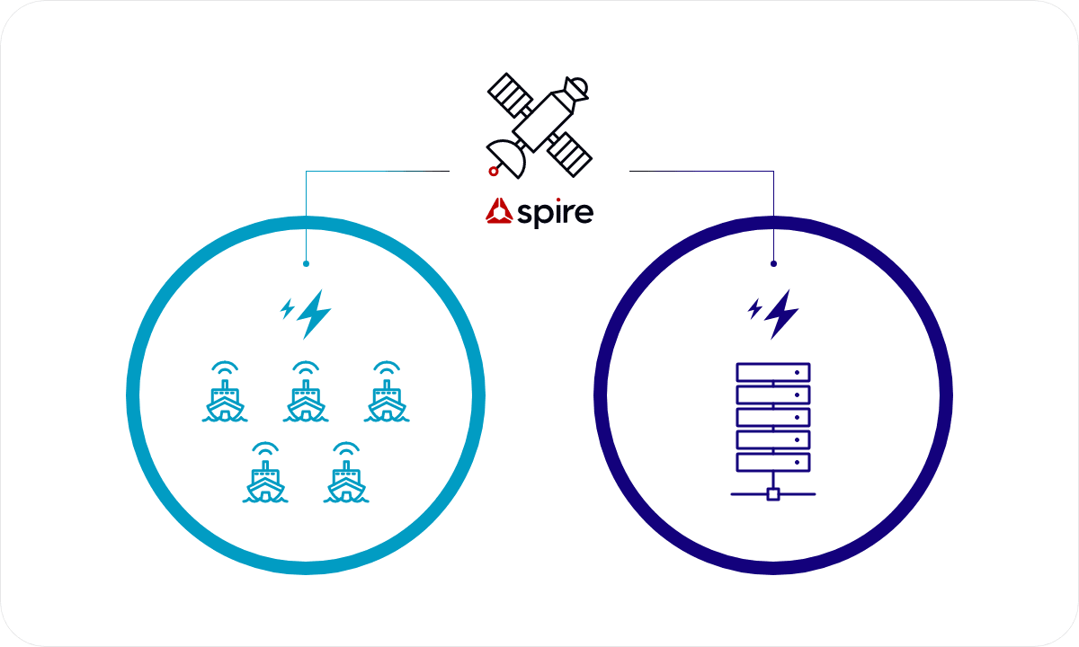
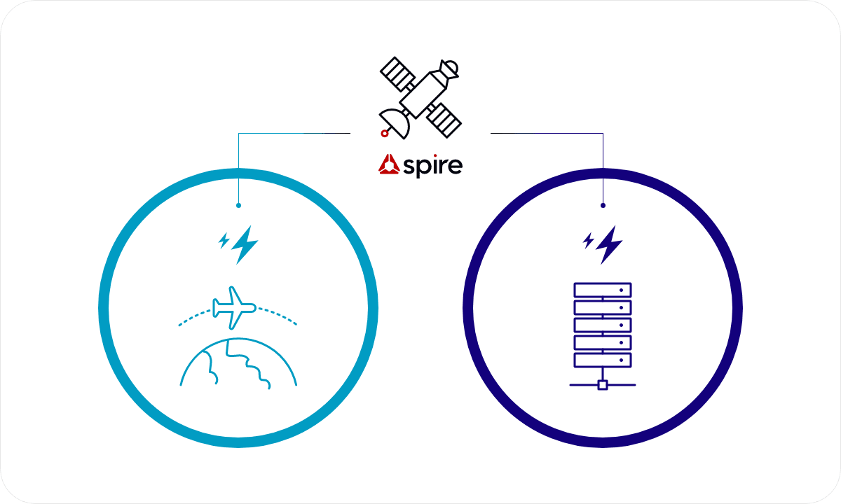
Spire Global provides a variety of data analysis, information, and solutions using artificial satellites, including Earth's weather, maritime conditions, and the positions of aircraft and vessels.
Spire Global possesses a top-tier satellite infrastructure.
AIS, transmitted by shipborne transceivers as a legal requirement, provides data collected by exactEarth & Spire satellites, on land and from maritime authorities, regarding ship locations.
Providing historical, current, and forecast weather data from around the world collected by Spire's satellites.
ADS-B, transmitted by aircraft transponders as a legal requirement, offers aircraft identification services through Spire's satellites for tracking aircraft positions.
Ground Station
Satellite in Operation
Eco Marine is the official reseller of Spire Global in Korea.
AIS (Automatic Identification System) is a statutory device
that automatically transmits the location of a vessel.
The system that collects ship location information by mounting
an AIS receiver on a satellite is called satellite AIS.
provided worldwide via 100+ low Earth orbit satellites.
provided by exactEarth's satellite AIS service through Cross Link technology installed on satellites, ensuring zero latency.
service offering ship location information in shadow zones through AIS receivers attached to 3,500 vessels.
Possessing a decade's worth of AIS data from 280,000 vessels worldwide.
Utilizing the AI technology owned by Eco Marine,
we
provide data processing services.
The Spire Weather service utilizes Radio Occultation technology from over 100 meteorological satellites, collecting thousands of atmospheric data points daily. It monitors pressure, humidity, temperature, and more, from around the world and especially from remote and maritime regions.
Spire provides historical, current, and future forecast data collected from 100+ Radio Occultation satellites.
Possessing 30 years of global historical data.
(Updated every 1 hour)
Updating global weather on an hourly basis.
(3 km resolution)
Predictive data for global or regional forecasts.
(10 days forecast)
Through maritime-focused weather capabilities, we offer services for optimal recommended routes for ships, as well as weather and forecast information specific to ports.
Spire Weather utilizes weather sensors, Spire's satellite weather observations, and other sources to learn weather patterns in specific regions, combining machine learning techniques to create accurate forecasts.
Accessing customized weather forecasts for specific locations, allowing efficient work planning and ensuring maximum accuracy, thus enhancing business productivity.
Collecting data from ports and 10,500 weather observation stations to provide forecasts.
ADS-B stands for Automatic Dependent Surveillance - Broadcast. It is a system that autonomously collects aircraft information such as position, altitude, and speed at regular intervals. It plays an increasingly vital role in various aspects of the aviation industry, contributing to safety and efficiency enhancements.
Real time/past
Flight tracking service
API provided
Tail Number, Aircraft Code, Aircraft Code Type name, Airline code, Airline name
Flight Number, Departure time, Arrival time, Departure Aircraft Code, Arrival Aircraft Code, IATA and ICAO codes
Estimated time of arrival estimated time of departure Takeoff time, Landing time