Ecomarine will always be with customers.
OceanLook uses satellites to provide various data analysis information and solutions, such as Earth's weather, ocean conditions, and the location of aircraft and ships.
OceanLook monitors and analyzes ships worldwide.
AIS provides data collected by exactEarth & Spire satellites, land and ship stations with ship positioning transmitters attached as legal equipment
Provides historical, current, and forecast weather data from Spire's satellites to a global reach.
ADS-B is an aircraft location transmitter attached as a statutory equipment and provides aircraft location identification service through Spire's satellites.
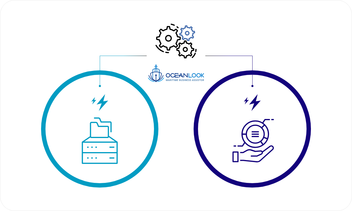
OceanLook provides MAP, API, and DATA Market services.
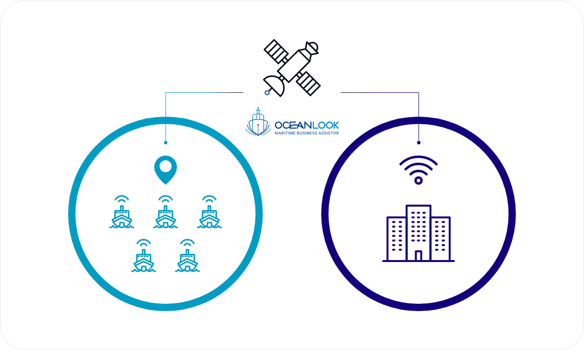
OceanLook-specific capabilities monitor and analyze ships around the world using leading maritime tracking systems.
Display the current position on the map by using the information of the ship position transmitter AIS collected from satellites
Display the names and coordinates of ports around the world
Displays EEZ (Exclusive Economic Zone), ECA (Environmental Control Area), pirate haunt area, etc.
After setting the area on the map, it automatically detects when it leaves or enters the area and notifies the departure/arrival of the vessel.
Display marine weather information on a map
Check detailed ship information by providing historical or real-time ship quantity and periodic AIS data
After setting the area on the map, it automatically detects when it leaves or enters the area and notifies the departure/arrival of the vessel.
Displays past movement routes of ships and ports of entry and departure on a map
OceanLook provides information to its customers in the form of a subscription.
You can select and receive Basic, Platinum, Platinum +, and Custom services.
| Service | Basic | Platinum | Platinum + |
|---|---|---|---|
| Basic Function | LVI (Latest Vessel Information) | LVI (Latest Vessel Information) | LVI (Latest Vessel Information) |
| World Vessel Display (24 hours ago) | World Vessel Display (24 hours ago) | World Vessel Display (24 hours ago) | |
| PastTrack (60 days) | PastTrack (60 days) | PastTrack (60 days) | |
| Search (All Vessels/Top 500 Ports) | Search (All Vessels/Top 500 Ports) | Search (All Vessels/Top 500 Ports) | |
| MyFleet View/Add/Delete | My Fleet View/Add/Delete | MyFleet View/Add/Delete | |
| Platinum Function | - | Geofence | Geofence |
| - | PortCall | PortCall | |
| - | FutureTrack (Destination/manual) | FutureTrack (Destination/manual) | |
| - | Search (Vessels/Ports) | Search (Vessels/Ports) | |
| - | Playback (60 days), 5 vessels | Playback (60 days), 5 vessels | |
| - | Port Congestion (Top 500 Ports) | Port Congestion (Top 500 Ports) | |
| Platinum + Function | - | - | 2-Level Capability without Vessel Registration |
| - | - | Display of All Vessels' Bearings | |
| - | - | PastTrack (180 days) | |
| - | - | Playback (180 days) |
| Custom |
|---|
| Select from Basic Functions |
| Select from Basic Functions |
| Select from Platinum Functions |
| Select from Platinum + Functions |
| Specialized Features Provided |
| Vessel IoT + Vessel Location Integration |
| Chart Integration for Track Display |
| Dedicated Geofence Alert Function |
| Display of Identical Vessel Tracks |
| Display of Expected Arrivals at Ports |
| Event Email, KakaoTalk Integration |
| Standard Code Naming for Ports |
| Integration with ERP, etc. |
| Embedded, Pop-Up Map Integration |
| Others |
If the company has its own map-based monitoring system,
Or, if you have a computer team, you can receive text-based
data services through API.
| Category | Service | Description | |
|---|---|---|---|
| Location Information | Historical Location Search | Vessel Past Track | Provides historical routes for a 1-month period |
| Historical Data by Area and by Time | Ship historical data by area and time | ||
| Real-time Location Search | Vessel Current Position | Real-time latest ship position inquiry including latitude, longitude, etc. | |
| Search All Vessels | Global ship search by IMO, MMSI, or ship name | ||
| Navigation Information | A.I Port Code Mapping | Standardization of port codes | |
| Vessel List to Destined Port | Provides expected arrival port | ||
| ATA/ATB/ATD | Actual departure/arrival and berthing times of ships | ||
| Port Call | Recent departure/arrival port information | ||
| Vessel List to Destined Port | Provides expected arrival port | ||
| Future Track | Future routes and calculated arrival times | ||
| Specialized Functions | Geo Fence | In/Enter/Exit alerts for ships within specified areas | |
| Future Track | Ship location and port-specific weather information | ||
| Port Congestion | Port congestion details including waiting times and anchored ship quantities | ||
| Customer's On-Demand Info Displaying | Integration with customer's ERP and other systems | ||
Ship AIS data, marine meteorological data, data preprocessing/processing analysis/machine learning service As a data voucher supplier, data extraction and preprocessing through data analysis design, clustering and AI modeling Provides data visualization when needed.
| Category | Type | Service | Description |
|---|---|---|---|
| Location Information | Historical Data | Extracted from DB, Manual Provision | Differentiated provision by period and ship |
| Real-time Data | Provided via In-house Developed API | Differentiated provision by period, ship, and update cycle | |
| Additional Data | Provided via In-house Developed API | Route prediction, additional destination port codes provided | |
| Analysis Services | Historical Data | Manual provision of analyzed data using in-house developed data analysis techniques | Processing and analysis data provided based on customer's requirements |